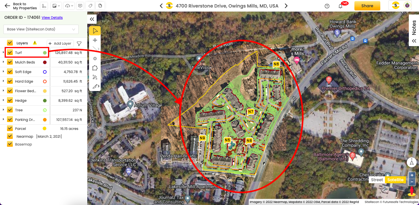
The SiteRecon map gives you various options to interact with it and the associated data. You can adjust the layers on the map to get the best possible view, and you can dynamically access your map's intricacies using this full-blown navigation feature.
1. Layer styling
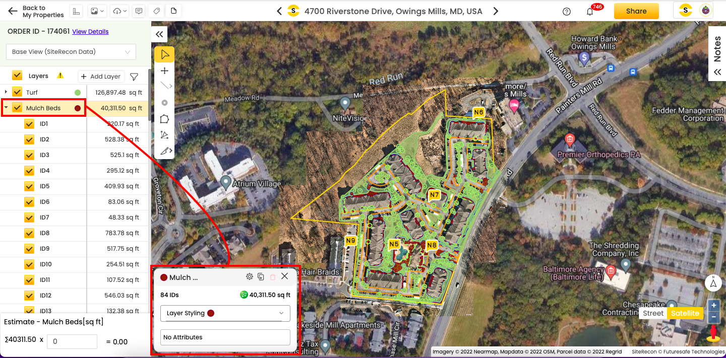
Since the map has hundreds of layers, it may be challenging to distinguish the suitable layer. SiteRecon allows you to select and stylize a layer to make it stand out. Here's how to do it.
- Select the layer you want to style from the layer panel by left-clicking it once. This action will open a styling pop-up, as illustrated in the image below, where you can customize the layer’s appearance.
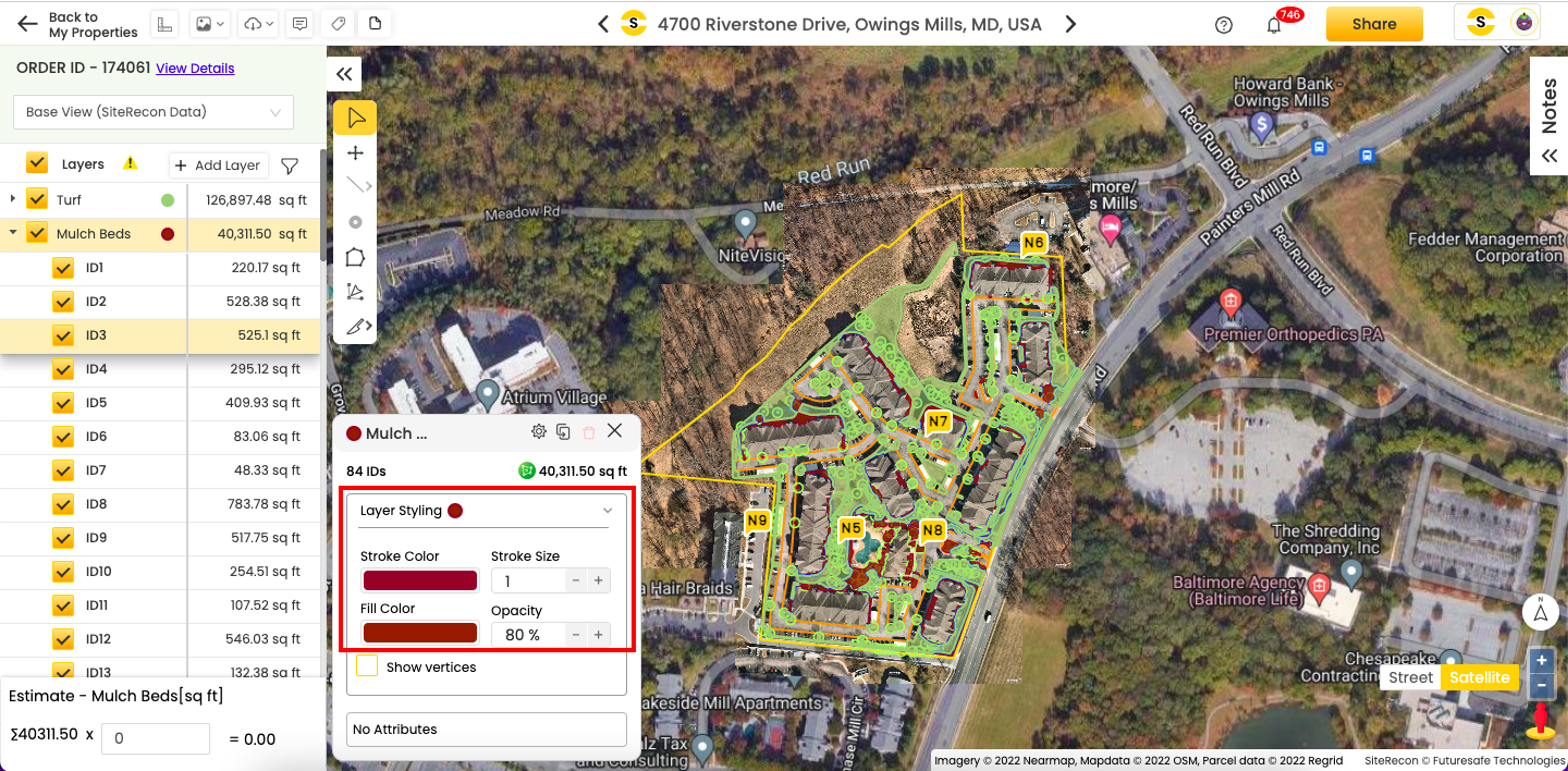
- In this pop-up, click on the dropdown arrow to expand the Layer styling menu. Adjust the Stroke Color or Fill Color as per your choice. The shade you will pick in the pop-up will reflect on the map at the same time.
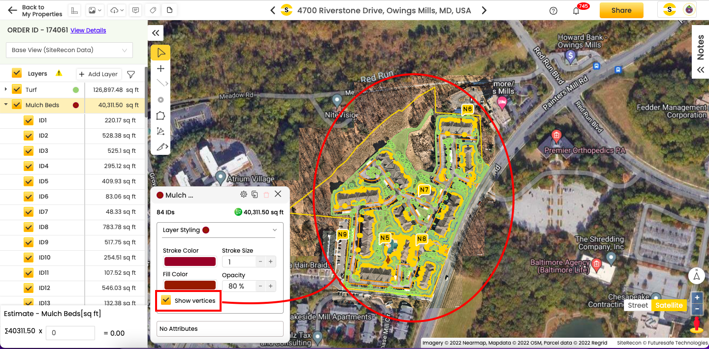
- Toggle between the Show vertices option to view the vertices of the layer parcel
2. Hiding/showing layers
Click the checkbox against a layer to hide/show it on the property map. Refer to the images below.
Hidden turf layer:
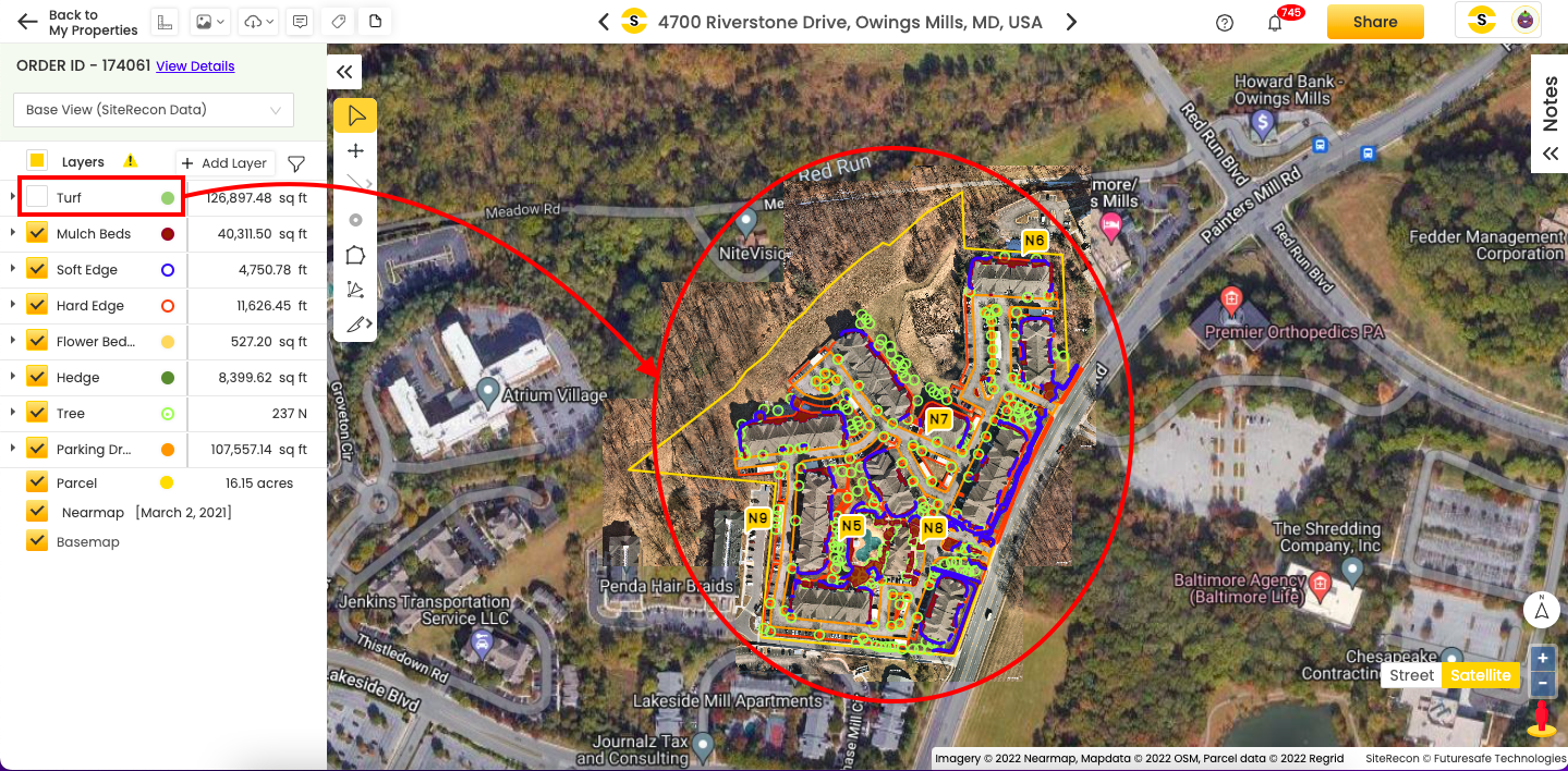
Visible turf layer:
3. Interacting with maps and layers
Real-time interaction between the maps and layers makes it easier for you to locate it right. It also helps you identify the IDs on the go.
- If you select a layer ID from the layer panel, the corresponding area will get highlighted on the property map at the same time. Also, if you just hover the pointer (using either the mouse or the touchpad) over layer ID from the layer panel, it will get highlighted on the map screen too. Refer to the picture below.
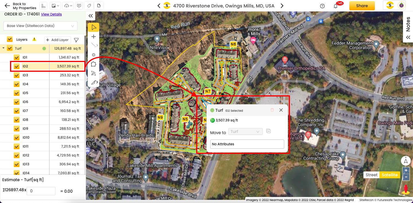
- The above pointer holds in a vice-versa scenario too, except for the hovering part – if you click on any of the layer IDs on the map screen, it will get highlighted in the layer panel.